UP district map with all 75 districts, divisions and RTO codes
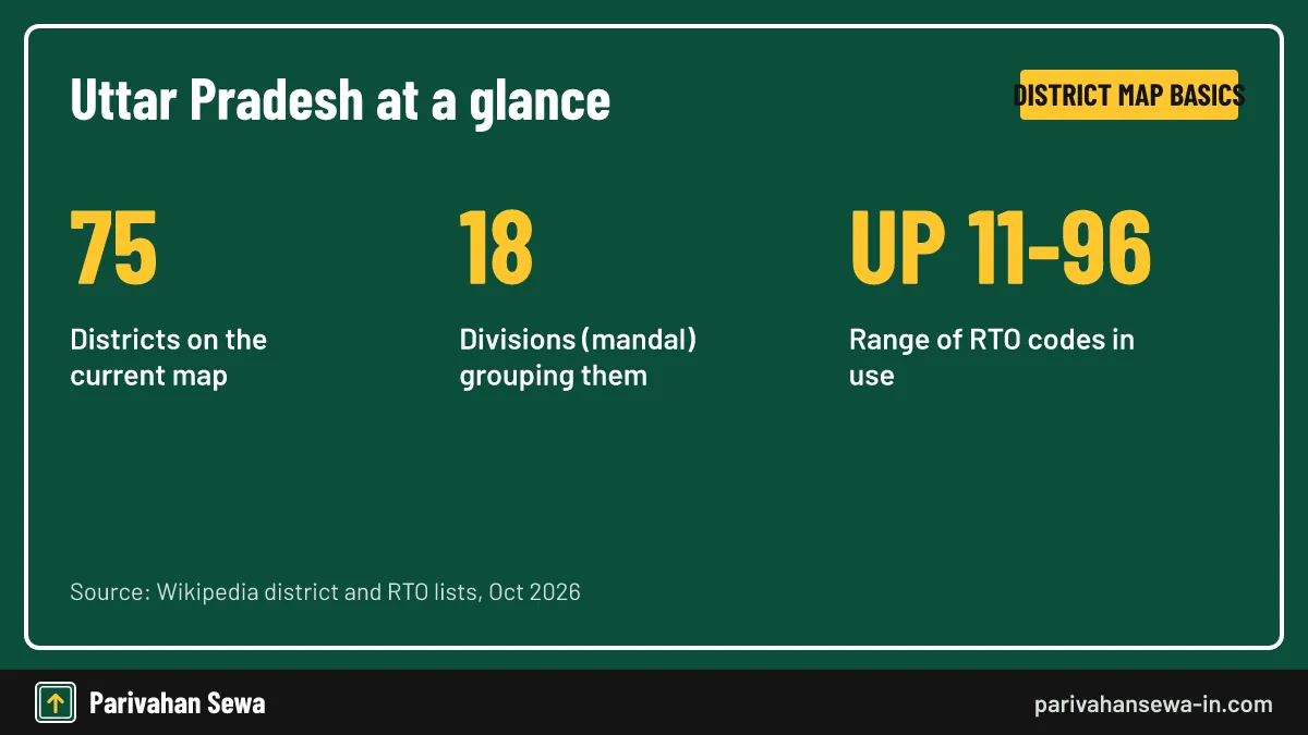
The UP district map shows 75 districts grouped into 18 divisions, from Saharanpur in the north-west to Ballia on the Bihar border and Lalitpur in the south. Each district has a headquarters town and an RTO code between UP 11 and UP 96. Use the division lists and master table below to place any district, town or number plate.
Key takeaways
- Uttar Pradesh has 75 districts in 18 divisions; the Kumbh Mela area was only a temporary 76th district in 2025.
- Western UP is usually counted as 26 districts in six divisions, from Saharanpur to Bareilly and Agra.
- UP 12 is Muzaffarnagar; codes rise from UP 11 in the west to UP 96 Chitrakoot in the south.
- The state had 1,06,774 revenue villages in 2011, of which 97,814 were inhabited.
- Use maps that show Prayagraj and Ayodhya, not Allahabad and Faizabad, to be sure the boundaries are current.
On this page · 39 sections
What does the UP district map show?
A UP district map draws the borders of all 75 districts of Uttar Pradesh, the headquarters town of each, and usually the 18 divisions that group them. Good versions also mark the neighbouring states, the Nepal border and the main rivers, so you can place any town in seconds.
The layers on a typical map
Most printed maps stack three layers: the state outline, district boundaries, and district headquarters as dots. Better editions add division borders in a heavier line, plus the Ganga, Yamuna and Ghaghra, which help you read direction at a glance.
What this guide adds to the map
A picture alone does not tell you a district’s code or division. Here every district is paired with its headquarters, division and RTO code, so the same list works for travel planning, exam revision and decoding a number plate you saw on the road.
How many districts appear on the Uttar Pradesh district map?
The current Uttar Pradesh district map shows 75 districts. That figure has held since 2011, when Hapur, Shamli and Sambhal were added. For a fuller count-focused explainer in Hinglish, see our page on UP me kitne jile hai.
Why some maps show a different number
Older school maps may show 70, 71 or 72 districts because they were printed before the 2008 to 2011 additions. Maps from before November 2000 also include the hill districts that now form Uttarakhand, which has 13 districts of its own.
The temporary 76th district
On 2 December 2024 the state declared the Maha Kumbh Mela area, made of 67 villages from four Prayagraj tehsils, a temporary district for the 2025 Kumbh. It was later merged back, so permanent maps still carry 75.
How is the UP map district wise split into 18 divisions?
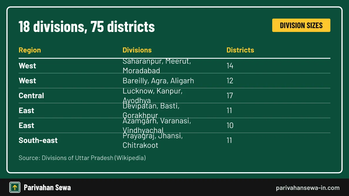
On a UP map district wise, districts are grouped into 18 divisions, each led by a divisional commissioner. Divisions range from three districts, such as Saharanpur or Basti, to six, such as Meerut, Kanpur and Lucknow. Most divisions take their name from their headquarters city.
| Division | Headquarters | Districts | Usual region |
|---|---|---|---|
| Saharanpur | Saharanpur | 3 | West |
| Meerut | Meerut | 6 | West |
| Moradabad | Moradabad | 5 | West |
| Bareilly | Bareilly | 4 | West |
| Agra | Agra | 4 | West |
| Aligarh | Aligarh | 4 | West |
| Lucknow | Lucknow | 6 | Central |
| Kanpur | Kanpur | 6 | Central |
| Ayodhya | Ayodhya | 5 | Central-east |
| Devipatan | Gonda | 4 | North-east |
| Basti | Basti | 3 | East |
| Gorakhpur | Gorakhpur | 4 | East |
| Azamgarh | Azamgarh | 3 | East |
| Varanasi | Varanasi | 4 | East |
| Vindhyachal | Mirzapur | 3 | South-east |
| Prayagraj | Prayagraj | 4 | South-east |
| Jhansi | Jhansi | 3 | Bundelkhand |
| Chitrakoot | Banda | 4 | Bundelkhand |
Two divisions not named after their HQ
Devipatan division is run from Gonda, and Vindhyachal division from Mirzapur. For Chitrakoot division, the Banda district website calls Banda the commissionery headquarters, although some lists name Chitrakoot instead.
Region labels are informal
The “usual region” column follows common practice in news and exam material. The state has no notified boundary for west, central or east UP, so treat these labels as a reading aid rather than an official tier.
Which districts are in Saharanpur division?
Saharanpur division holds three districts in the far north-west corner: Saharanpur, Muzaffarnagar and Shamli. The division sits between the Yamuna, which marks the Haryana border, and the foothills of Uttarakhand. Its RTO codes are UP 11, UP 12 and UP 19.
Shamli’s short history
Shamli was carved out of Muzaffarnagar on 28 September 2011 as Prabudh Nagar and renamed Shamli in July 2012. On an older map you will find its towns inside Muzaffarnagar district.
Where the division sits on the map
Look at the top-left tip of the state outline. Saharanpur district touches the hills; Muzaffarnagar and Shamli lie just south of it on the plains, on the road and rail corridor running down towards Meerut and Delhi.
Which districts sit in Meerut division?
Meerut division has six districts in the upper Ganga-Yamuna doab: Meerut, Baghpat, Ghaziabad, Gautam Buddha Nagar, Hapur and Bulandshahr. Ghaziabad and Gautam Buddha Nagar share a border with Delhi, which puts much of this division inside the National Capital Region.
Codes in the Meerut belt
The office codes run UP 13 to UP 17 plus UP 37: Bulandshahr 13, Ghaziabad 14, Meerut 15, Gautam Buddha Nagar 16, Baghpat 17 and Hapur 37. Our UP 14 district name guide explains the Ghaziabad and Noida codes in more depth.
Headquarters to note
Gautam Buddha Nagar is run from Greater Noida, not Noida. Hapur, earlier named Panchsheel Nagar, is the smallest district in the state by area, at about 649 sq km.
Which districts fall in Moradabad division?
Moradabad division covers five districts in western Rohilkhand: Moradabad, Bijnor, Amroha, Sambhal and Rampur. Bijnor reaches up to the Uttarakhand border in the north, and the Ganga forms much of the division’s western edge.
Renamed districts here
Two districts in this division carried other names earlier. Amroha was Jyotiba Phule Nagar until 2012, and Sambhal was briefly called Bhimnagar. Sambhal’s headquarters is Bahjoi, which is also where its UP 38 office sits.
Moradabad division codes
Moradabad uses UP 21, Rampur UP 22, Amroha UP 23, Bijnor UP 20 and Sambhal UP 38. The Moradabad and Rampur offices also issue letter-suffixed series for government and commercial vehicles, according to Wikipedia’s RTO list.
What does Bareilly division cover?
Bareilly division takes in four districts of eastern Rohilkhand: Bareilly, Budaun, Pilibhit and Shahjahanpur. It lies south of the Uttarakhand border, and Pilibhit district also touches Nepal. The codes are UP 25, UP 24, UP 26 and UP 27.
Pilibhit on the international border
Pilibhit is the westernmost of the seven districts along the Nepal border. On a map, follow the state’s northern edge east from Uttarakhand and Pilibhit is the first district you meet on that frontier.
Bareilly as a hub
Bareilly city is the division and district headquarters. For the meaning of its plate code, see our UP 25 district name page, which keeps to the Bareilly office and its series.
Which districts make up Agra division?
Agra division groups four districts along the Yamuna in the south-west: Agra, Firozabad, Mainpuri and Mathura. Agra and Mathura share a border with Rajasthan, and Mathura also meets Haryana. The codes are UP 80, UP 83, UP 84 and UP 85.
Braj country on the map
Mathura district, about 3,340 sq km, holds the Braj pilgrimage towns such as Vrindavan and Govardhan. It sits at the north-west end of the division, on the road from Delhi to Agra.
Firozabad and Mainpuri
Firozabad became a district on 5 February 1989, cut from Agra. Mainpuri lies further east, between Firozabad and Etawah, which belongs to Kanpur division.
Which districts are in Aligarh division?
Aligarh division has four districts in the doab between the Meerut and Agra belts: Aligarh, Etah, Hathras and Kasganj. Their codes are UP 81, UP 82, UP 86 and UP 87. Hathras was created in 1997 and Kasganj in 2008.
Kasganj’s earlier name
Kasganj was formed on 15 April 2008 and was known for a time as Kanshiram Nagar. Its main tehsils are Kasganj, Patiyali and Sahawar.
A proposed new district
In October 2025 news reports described a proposed Kalyan Singh Nagar district built from parts of Aligarh and Bulandshahr. We found no final notification by October 2026, so it does not appear on current maps.
Which districts form Kanpur division?
Kanpur division spans six districts in the lower doab: Kanpur Nagar, Kanpur Dehat, Etawah, Auraiya, Kannauj and Farrukhabad. The Ganga runs along its northern side and the Yamuna along the south, with Etawah reaching the Madhya Pradesh border near the Chambal.
Two Kanpurs on one map
Kanpur Nagar is the city district, coded UP 78. Kanpur Dehat is the rural district beside it, run from Akbarpur and coded UP 77. It became a separate district on 23 April 1981.
HQ names that differ
Farrukhabad district is run from Fatehgarh, and Kannauj became a district in 1997. The other codes are Kannauj UP 74, Etawah UP 75, Farrukhabad UP 76 and Auraiya UP 79.
Which districts are in Lucknow division?
Lucknow division has six districts in central Awadh: Lucknow, Hardoi, Lakhimpur Kheri, Rae Bareli, Sitapur and Unnao. It stretches from the Nepal border in the north down to the Ganga in the south, with the state capital near its centre.
The largest district in the state
Lakhimpur Kheri, about 7,680 sq km, is the largest district of Uttar Pradesh by area. It sits on the Nepal border and uses code UP 31. Hardoi, at about 5,986 sq km, is also among the biggest.
Lucknow’s place in the code list
Lucknow uses UP 32, and our UP 32 district name guide covers that code in detail. Hardoi is UP 30, Rae Bareli UP 33, Sitapur UP 34 and Unnao UP 35.
Which districts are in Ayodhya division?
Ayodhya division holds five districts east of Lucknow: Ayodhya, Barabanki, Sultanpur, Amethi and Ambedkar Nagar. The Ghaghra river, called the Saryu at Ayodhya, runs along its northern side. Codes are UP 42, UP 41, UP 44, UP 36 and UP 45.
Faizabad became Ayodhya
The district long marked as Faizabad on maps was renamed Ayodhya in 2018, and the division took the same name. Code UP 42 is now listed under Ayodhya.
Headquarters to watch
Amethi is run from Gauriganj and was created on 1 July 2010. Ambedkar Nagar is run from Akbarpur, a town that should not be confused with the Akbarpur headquarters of Kanpur Dehat.
Where is Devipatan division?
Devipatan division lies in the north-east, along the Nepal border, with its headquarters at Gonda. It holds four districts: Gonda, Bahraich, Shravasti and Balrampur. Three of them, all except Gonda, touch Nepal. Codes are UP 43, UP 40, UP 46 and UP 47.
Shravasti and Balrampur
Both districts were created in 1997. Shravasti is run from Bhinga and, with about 1,640 sq km, is one of the smaller districts in the region. Balrampur lies to its east.
Reading the Terai on the map
This part of the map is the Terai, the flat strip below the Himalayan foothills. Rivers flowing south from Nepal cross it, which is why maps of the area often show many small streams.
Which districts are in Basti division?
Basti division has three districts between Devipatan and Gorakhpur: Basti, Sant Kabir Nagar and Siddharthnagar. Siddharthnagar runs up to the Nepal border. Their codes are UP 51, UP 58 and UP 55.
Sant Kabir Nagar’s headquarters
Sant Kabir Nagar was created in 1997 and is run from Khalilabad, which is also where its RTO office is listed. Look for Khalilabad, not “Sant Kabir Nagar”, as a town label.
Siddharthnagar’s origin
Siddharthnagar became a district on 29 December 1988. Its office code UP 55 sits in the same 50s block as its eastern neighbours.
Which districts are in Gorakhpur division?
Gorakhpur division groups four districts in the north-east corner: Gorakhpur, Deoria, Kushinagar and Maharajganj. Maharajganj touches Nepal, while Kushinagar and Deoria meet Bihar to the east. Codes run UP 53, UP 52, UP 57 and UP 56.
Kushinagar and Maharajganj
Kushinagar became a district on 13 May 1994 and is run from Padrauna. Maharajganj dates from 2 October 1989. Both were carved from the older Gorakhpur and Deoria areas.
Deoria on the plate list
Deoria uses UP 52. Gorakhpur city, the division headquarters, is the largest urban centre in this corner of the state and uses UP 53.
Which districts form Azamgarh division?
Azamgarh division has three districts in the east: Azamgarh, Mau and Ballia. Ballia forms the eastern tip of Uttar Pradesh, where the Ganga and Ghaghra meet near the Bihar border. Codes are UP 50, UP 54 and UP 60.
Mau’s separation
Mau was cut from Azamgarh on 19 November 1988. On pre-1988 maps its towns appear inside Azamgarh district.
Azamgarh’s size
Azamgarh district had about 46.1 lakh people in 2011, making it one of the more populous districts in the east, on about 4,054 sq km.
Which districts are in Varanasi division?
Varanasi division covers four districts along the middle Ganga: Varanasi, Chandauli, Ghazipur and Jaunpur. Chandauli and Ghazipur border Bihar. The codes are UP 65, UP 67, UP 61 and UP 62.
Varanasi is small on the map
Varanasi district covers only about 1,535 sq km, yet held about 36.8 lakh people in 2011. For the city’s plate code, see our UP 65 district name page.
Chandauli and Jaunpur
Chandauli became a district in 1997, carved from Varanasi. Jaunpur, north-west of Varanasi, is the largest district of the division by area at about 4,038 sq km.
Where is Vindhyachal division?
Vindhyachal division sits in the south-east, south of the Ganga, with its headquarters at Mirzapur. Its three districts are Mirzapur, Bhadohi and Sonbhadra, coded UP 63, UP 66 and UP 64. The Vindhya hills give the division its name.
Sonbhadra’s corner of the state
Sonbhadra, about 6,905 sq km and run from Robertsganj, is the second-largest district by area. It forms the south-eastern corner where UP meets Madhya Pradesh, Chhattisgarh, Jharkhand and Bihar.
Bhadohi’s RTO office
Bhadohi became a district on 30 June 1994. Its headquarters is Bhadohi, but the published RTO list places its UP 66 office at Gyanpur.
Which districts are in Prayagraj division?
Prayagraj division holds four districts around the meeting of the Ganga and Yamuna: Prayagraj, Fatehpur, Kaushambi and Pratapgarh. Prayagraj district also reaches the Madhya Pradesh border to the south. Codes are UP 70, UP 71, UP 73 and UP 72.
The most populous district
Prayagraj, earlier Allahabad, had about 59.5 lakh people in 2011, the highest of any district in the state. It also hosts the Allahabad High Court.
Kaushambi’s headquarters
Kaushambi was created in 1997 and is run from Manjhanpur. Fatehpur lies to its west, along the road between Kanpur and Prayagraj.
Which districts are in Jhansi division?
Jhansi division covers three districts of western Bundelkhand: Jhansi, Jalaun and Lalitpur. All three border Madhya Pradesh, and Lalitpur pushes deep into MP territory. Their codes are UP 93, UP 92 and UP 94.
Lalitpur’s shape
Lalitpur, about 5,039 sq km and formed on 1 March 1974, is almost wrapped by Madhya Pradesh. On a map it looks like a southern spur hanging from the rest of the state.
Jalaun’s headquarters
Jalaun district is run from Orai, not from the town of Jalaun. Jhansi district is the largest of the three by area. For the Jhansi plate code, see our UP 93 district name page.
Which districts are in Chitrakoot division?
Chitrakoot division covers four districts of eastern Bundelkhand: Banda, Chitrakoot, Hamirpur and Mahoba. It lies south of the Yamuna and borders Madhya Pradesh. Codes are UP 90, UP 96, UP 91 and UP 95.
Mahoba, the least populous district
Mahoba, formed on 11 February 1995, had about 8.76 lakh people in 2011, the fewest of the 75 districts. It sits west of Banda and south of Hamirpur.
Chitrakoot’s headquarters
Chitrakoot district, created in 1997, is run from Karwi. Its RTO entry is listed as Chitrakoot Dham, the last code in the state series, UP 96.
What is the west UP district list?
The usual west UP district list has 26 districts in six divisions: Saharanpur, Meerut, Moradabad, Bareilly, Agra and Aligarh. The grouping comes from common usage and political debate, not a government notification, so some writers drop Bareilly or add Etawah.

The 26 districts by division
Saharanpur: Saharanpur, Muzaffarnagar, Shamli. Meerut: Meerut, Baghpat, Ghaziabad, Gautam Buddha Nagar, Hapur, Bulandshahr. Moradabad: Moradabad, Bijnor, Amroha, Sambhal, Rampur. Agra: Agra, Mathura, Firozabad, Mainpuri. Aligarh: Aligarh, Etah, Hathras, Kasganj. Bareilly: Bareilly, Budaun, Pilibhit, Shahjahanpur.
Harit Pradesh and other names
Some parties have demanded statehood for this belt under the name Harit Pradesh; Braj Pradesh and Pashchim Pradesh have also been suggested. None of these proposals has changed the map.
Which are the Uttar Pradesh east cities?
The best-known Uttar Pradesh east cities are the district towns of Purvanchal: Varanasi, Gorakhpur, Azamgarh, Jaunpur, Ghazipur, Ballia, Mau, Deoria, Basti and Mirzapur. Purvanchal is the Bhojpuri-speaking east, and a proposed Purvanchal state would cover 32 eastern districts.

Cities by division
Varanasi division gives Varanasi, Jaunpur, Ghazipur and Chandauli; Gorakhpur division gives Gorakhpur, Deoria, Padrauna and Maharajganj; Azamgarh division gives Azamgarh, Mau and Ballia. Mirzapur and Robertsganj anchor the south-east.
Where the east begins
Sources disagree on the western edge of the east. Some start it at Ayodhya division, others at Basti and Gorakhpur. Pick the definition your exam, report or employer uses and say which one you followed.
How does the UP full map split into regions?
A UP full map is easiest to read in five broad regions: the west (Doab and Rohilkhand), central Awadh around Lucknow, the north-eastern Terai, Purvanchal in the east, and Bundelkhand in the south. Each region links to a run of RTO codes.
| Region | Divisions | Districts | Code range |
|---|---|---|---|
| West | Saharanpur, Meerut, Moradabad, Bareilly, Agra, Aligarh | 26 | UP 11 to 27, 37, 38, 80 to 87 |
| Central (Awadh) | Lucknow, Kanpur, Ayodhya | 17 | UP 30 to 36, 41, 42, 44, 45, 74 to 79 |
| North-east and east | Devipatan, Basti, Gorakhpur, Azamgarh, Varanasi | 18 | UP 40, 43, 46, 47, 50 to 62, 65, 67 |
| South-east | Vindhyachal, Prayagraj | 7 | UP 63, 64, 66, 70 to 73 |
| Bundelkhand | Jhansi, Chitrakoot | 7 | UP 90 to 96 |
Codes follow geography loosely
The RTO numbers were handed out roughly region by region, so the 10s and 20s sit in the west and the 90s in Bundelkhand. Later districts got spare numbers, which is why Hapur (UP 37) breaks the western run.
Central UP and Awadh
Awadh is the historic name for the Lucknow and Ayodhya belt. Kanpur division is often added to “central UP” in news coverage, but it is not historically part of Awadh.
Which districts form Bundelkhand on the UP state map with districts?
On a UP state map with districts, the Bundelkhand part holds seven districts across two divisions: Jhansi, Jalaun and Lalitpur in Jhansi division, and Banda, Chitrakoot, Hamirpur and Mahoba in Chitrakoot division. Together they form the state’s southern edge, bordering Madhya Pradesh.

A neat block of codes
Bundelkhand is the one region that uses an unbroken code run, UP 90 to UP 96. That makes it easy to spot these districts from a plate alone.
Bundelkhand across two states
Bundelkhand as a cultural region extends into Madhya Pradesh. A map labelled “Bundelkhand” may therefore show MP districts too; only the seven above are inside UP.
Uttar Pradesh map with district name: master table
This Uttar Pradesh map with district name table lists all 75 districts by division, with the headquarters town and RTO code. HQ names come from Wikipedia’s district list and codes from its RTO table, both checked in October 2026.
| District | HQ | Division | RTO code |
|---|---|---|---|
| Saharanpur | Saharanpur | Saharanpur | UP 11 |
| Muzaffarnagar | Muzaffarnagar | Saharanpur | UP 12 |
| Shamli | Shamli | Saharanpur | UP 19 |
| Meerut | Meerut | Meerut | UP 15 |
| Baghpat | Baghpat | Meerut | UP 17 |
| Ghaziabad | Ghaziabad | Meerut | UP 14 |
| Gautam Buddha Nagar | Greater Noida | Meerut | UP 16 |
| Hapur | Hapur | Meerut | UP 37 |
| Bulandshahr | Bulandshahr | Meerut | UP 13 |
| Moradabad | Moradabad | Moradabad | UP 21 |
| Bijnor | Bijnor | Moradabad | UP 20 |
| Amroha | Amroha | Moradabad | UP 23 |
| Sambhal | Bahjoi | Moradabad | UP 38 |
| Rampur | Rampur | Moradabad | UP 22 |
| Bareilly | Bareilly | Bareilly | UP 25 |
| Budaun | Budaun | Bareilly | UP 24 |
| Pilibhit | Pilibhit | Bareilly | UP 26 |
| Shahjahanpur | Shahjahanpur | Bareilly | UP 27 |
| Agra | Agra | Agra | UP 80 |
| Firozabad | Firozabad | Agra | UP 83 |
| Mainpuri | Mainpuri | Agra | UP 84 |
| Mathura | Mathura | Agra | UP 85 |
| Aligarh | Aligarh | Aligarh | UP 81 |
| Etah | Etah | Aligarh | UP 82 |
| Hathras | Hathras | Aligarh | UP 86 |
| Kasganj | Kasganj | Aligarh | UP 87 |
| Lucknow | Lucknow | Lucknow | UP 32 |
| Hardoi | Hardoi | Lucknow | UP 30 |
| Lakhimpur Kheri | Kheri | Lucknow | UP 31 |
| Rae Bareli | Rae Bareli | Lucknow | UP 33 |
| Sitapur | Sitapur | Lucknow | UP 34 |
| Unnao | Unnao | Lucknow | UP 35 |
| Kanpur Nagar | Kanpur | Kanpur | UP 78 |
| Kanpur Dehat | Akbarpur | Kanpur | UP 77 |
| Etawah | Etawah | Kanpur | UP 75 |
| Auraiya | Auraiya | Kanpur | UP 79 |
| Kannauj | Kannauj | Kanpur | UP 74 |
| Farrukhabad | Fatehgarh | Kanpur | UP 76 |
| Ayodhya | Ayodhya | Ayodhya | UP 42 |
| Barabanki | Barabanki | Ayodhya | UP 41 |
| Sultanpur | Sultanpur | Ayodhya | UP 44 |
| Amethi | Gauriganj | Ayodhya | UP 36 |
| Ambedkar Nagar | Akbarpur | Ayodhya | UP 45 |
| Gonda | Gonda | Devipatan | UP 43 |
| Bahraich | Bahraich | Devipatan | UP 40 |
| Shravasti | Bhinga | Devipatan | UP 46 |
| Balrampur | Balrampur | Devipatan | UP 47 |
| Basti | Basti | Basti | UP 51 |
| Sant Kabir Nagar | Khalilabad | Basti | UP 58 |
| Siddharthnagar | Siddharthnagar | Basti | UP 55 |
| Gorakhpur | Gorakhpur | Gorakhpur | UP 53 |
| Deoria | Deoria | Gorakhpur | UP 52 |
| Kushinagar | Padrauna | Gorakhpur | UP 57 |
| Maharajganj | Maharajganj | Gorakhpur | UP 56 |
| Azamgarh | Azamgarh | Azamgarh | UP 50 |
| Mau | Mau | Azamgarh | UP 54 |
| Ballia | Ballia | Azamgarh | UP 60 |
| Varanasi | Varanasi | Varanasi | UP 65 |
| Chandauli | Chandauli | Varanasi | UP 67 |
| Ghazipur | Ghazipur | Varanasi | UP 61 |
| Jaunpur | Jaunpur | Varanasi | UP 62 |
| Mirzapur | Mirzapur | Vindhyachal | UP 63 |
| Bhadohi | Bhadohi | Vindhyachal | UP 66 |
| Sonbhadra | Robertsganj | Vindhyachal | UP 64 |
| Prayagraj | Prayagraj | Prayagraj | UP 70 |
| Fatehpur | Fatehpur | Prayagraj | UP 71 |
| Kaushambi | Manjhanpur | Prayagraj | UP 73 |
| Pratapgarh | Pratapgarh | Prayagraj | UP 72 |
| Jhansi | Jhansi | Jhansi | UP 93 |
| Jalaun | Orai | Jhansi | UP 92 |
| Lalitpur | Lalitpur | Jhansi | UP 94 |
| Banda | Banda | Chitrakoot | UP 90 |
| Chitrakoot | Karwi | Chitrakoot | UP 96 |
| Hamirpur | Hamirpur | Chitrakoot | UP 91 |
| Mahoba | Mahoba | Chitrakoot | UP 95 |
How to use the table
Sort it mentally by the division column to see neighbours together, or scan the code column to decode a plate. Office addresses and timings are not listed here; check the Uttar Pradesh RTO guide or the transport department site for those.
Codes that are not in use
Numbers such as 18, 28, 29, 39, 48 and 49 do not appear in the main published table, and UP 1 to UP 10 went to districts that are now in Uttarakhand.
What is the UP 12 district name?
The UP 12 district name is Muzaffarnagar. UP 12 is the code of the registering office for Muzaffarnagar district in Saharanpur division, on the plains between Meerut and Saharanpur. Any vehicle first registered there shows UP 12 straight after the state letters.

UP 12 plates in Shamli
Shamli was part of Muzaffarnagar until 2011 and now has its own office, UP 19. Vehicles registered before the split keep their UP 12 number, so you may still see UP 12 plates owned by people living in Shamli.
If you meant the “12 districts” of 1997
Some searches for “UP 12 district” actually mean the twelve districts created in 1997: Amroha, Auraiya, Baghpat, Balrampur, Chandauli, Chitrakoot, Gautam Buddha Nagar, Hathras, Kannauj, Kaushambi, Sant Kabir Nagar and Shravasti.
What is the Uttar Pradesh code number?
The Uttar Pradesh code number depends on the system. Vehicle plates use the letters UP followed by an office number from 11 to 96. For GST, the state code is 09, which forms the first two digits of every GSTIN issued in Uttar Pradesh.
Vehicle code versus district code
On a plate, UP identifies the state and the two digits identify the RTO. There is no single number for a district outside this system, so a “district code” on a form usually means the RTO code or a department’s own internal code.
Codes you should not guess
Census, PIN and telephone codes each follow their own scheme. If a form asks for one of these, take the value from the issuing department’s own list rather than from a plate or a map.
How do you find a district from a UP number plate?
To find a district from a plate, read the two digits after UP, match them in the master table, and then use the division to place the district on the map. The code tells you the registering office, not where the owner lives today.

- Read the two digits. Note the number after UP, for example 62 in UP 62 AB 1234.
- Look up the code. Find 62 in the master table: Jaunpur, run from Jaunpur, in Varanasi division.
- Place it on the map. Varanasi division sits in the east, along the middle Ganga.
- Confirm the record. Search the full number on Vahan or mParivahan to see the official registering authority.
Why the owner may live elsewhere
A vehicle keeps its number when the owner moves within the state or when district borders change. A UP 12 car in Shamli or a UP 14 car in Hapur is normal for vehicles registered before those splits.
Where the code sits on new plates
High-security plates print the state letters and office number in the first block on the left, next to the chromium hologram. Older painted plates use the same order.
How many villages are in UP?
The number of villages in UP was 1,06,774 revenue villages in 2011, according to the state’s “UP in Figures 2022” publication: 97,814 inhabited and 8,960 uninhabited. We could not open the original PDF from our office, so confirm the figure on the state statistics site.
| Unit | Count | Reference date |
|---|---|---|
| Districts | 75 | 2026 |
| Divisions | 18 | 2026 |
| Tehsils | 351 | 31 March 2022 |
| Development blocks | 826 | 31 March 2022 |
| Revenue villages | 1,06,774 | Census 2011 |
| Inhabited villages | 97,814 | Census 2011 |
Inhabited and uninhabited villages
An uninhabited village is a revenue village with land records but no resident population at the census. These still appear on revenue maps, which is why village totals differ from the number of places where people live.
Finding a single village
To look up one village’s name, tehsil or block, see our guide to UP village name searches, which covers the revenue and land-record portals.
What does a UP jila map show below the district?
A UP jila map (district map) often shows the tehsils and development blocks inside one district, plus major towns, roads and rivers. The state had 351 tehsils and 826 development blocks as on 31 March 2022, so most districts hold several of each.
Tehsil versus block
A tehsil is a revenue unit for land records and collection, headed by a tehsildar. A development block is a rural planning unit run by a Block Development Officer. Their boundaries do not always match.
Counts change over time
The same state series showed 342 tehsils and 821 blocks in 2015-16. New tehsils and blocks are added from time to time, so check the district’s own website for its current count.
Where can you get a UP district map PDF?
A reliable UP district map PDF usually comes from three places: the Survey of India, which is the national mapping agency, the official websites of individual districts on nic.in, and the state portal up.gov.in. We do not host a downloadable PDF ourselves.

District websites
Most UP districts run an official site on the nic.in domain, for example banda.nic.in. Many include a district map or an “about the district” section with tehsil and block details.
Check before you print
Before using any UP map district wise PDF, count the districts and look for Prayagraj, Ayodhya, Hapur and Shamli. If any of these are missing or named differently, the file is out of date.
Is there a UP map district wise HD version?
A UP map district wise HD image is simply a high-resolution file, and its quality depends on the source. Vector maps from mapping agencies stay sharp when zoomed, while screenshots from social media blur and often carry old boundaries.
Picking a sharp file
Prefer PDF or SVG maps, which keep lines crisp at any size. For a JPG or PNG, check that district labels stay readable when you zoom to the size you need.
Licence and reuse
Maps from official agencies may carry copyright or reuse terms. If you plan to print or publish a map, read the terms on the site you downloaded it from.
How to read the UP ka map with district names
A UP ka map with district names is easiest to read if you start from four anchors: Lucknow in the centre, Meerut and Ghaziabad near Delhi in the west, Gorakhpur and Varanasi in the east, and Jhansi in the south. Every other district sits around these.
Use the rivers
The Ganga runs from the west down through Kanpur, Prayagraj and Varanasi to Ballia. The Yamuna forms the south-western edge before joining the Ganga at Prayagraj. Most districts lie north or south of one of these lines.
Hindi labels
If you prefer a map with Hindi labels, see our UP map district wise in Hindi guide. District names are the same; only the script changes.
Which UP districts touch Nepal and other states?
Uttar Pradesh borders Uttarakhand, Himachal Pradesh, Haryana, Delhi, Rajasthan, Madhya Pradesh, Chhattisgarh, Jharkhand and Bihar, plus Nepal to the north. Seven districts lie on the Nepal border, and many more line the state borders.
The seven Nepal border districts
From west to east they are Pilibhit, Lakhimpur Kheri, Bahraich, Shravasti, Balrampur, Siddharthnagar and Maharajganj. Security alerts on the frontier usually name these districts.
Busy interstate borders
Ghaziabad and Gautam Buddha Nagar face Delhi, Mathura faces Haryana and Rajasthan, and Ballia, Ghazipur and Deoria face Bihar. Bundelkhand’s seven districts all meet Madhya Pradesh.
Which are the largest and smallest districts on the UP map?
By area, Lakhimpur Kheri is the largest district at about 7,680 sq km and Hapur the smallest at about 649 sq km. By 2011 population, Prayagraj had the most people and Mahoba the fewest.
| Measure | District | Figure (2011 / area) |
|---|---|---|
| Largest by area | Lakhimpur Kheri | about 7,680 sq km |
| Second by area | Sonbhadra | about 6,905 sq km |
| Smallest by area | Hapur | about 649 sq km |
| Most populous | Prayagraj | 59,54,391 people |
| Least populous | Mahoba | 8,75,958 people |
Small but crowded districts
Gautam Buddha Nagar (about 720 sq km) and Ghaziabad (about 1,179 sq km) are small on the map but hold large urban populations. Area alone says little about how busy a district is.
State size for context
Uttar Pradesh covers about 2.41 lakh sq km and had about 19.98 crore people at the 2011 Census. For area figures in more detail, see our page on Uttar Pradesh area.
Which new districts changed the UP map?
The UP map has grown in steps since 1970s splits. The largest jump came in 1997, when twelve new districts were created. Kasganj followed in 2008, Amethi in 2010, and Hapur, Shamli and Sambhal in 2011.

Districts formed before 1997
Lalitpur (1974), Ghaziabad (1976), Kanpur Dehat (1981), Mau and Siddharthnagar (1988), Firozabad, Sonbhadra and Maharajganj (1989), Kushinagar and Bhadohi (1994), and Mahoba and Ambedkar Nagar (1995) were all carved from older districts.
Uttarakhand’s departure
On 9 November 2000 the hill districts left to form Uttarakhand. That change removed the northern hills from the UP map and is why plate codes UP 1 to UP 10 are no longer issued.
Which district names changed on the Uttar Pradesh map district wise?
Several labels on the Uttar Pradesh map district wise have changed. Allahabad became Prayagraj and Faizabad became Ayodhya in 2018, while Jyotiba Phule Nagar, Panchsheel Nagar, Prabudh Nagar, Bhimnagar and Kanshiram Nagar reverted to Amroha, Hapur, Shamli, Sambhal and Kasganj.
Old name, new name
| Old name | Current name |
|---|---|
| Allahabad | Prayagraj |
| Faizabad | Ayodhya |
| Jyotiba Phule Nagar | Amroha |
| Panchsheel Nagar | Hapur |
| Prabudh Nagar | Shamli |
| Bhimnagar | Sambhal |
| Kanshiram Nagar | Kasganj |
Why old names linger
Government records, older RCs and printed maps keep the name in use when they were made. A document that says Faizabad is still valid; it simply predates the renaming.
Common mistakes when reading a UP district map
Most errors come from outdated maps and from towns that share a name. A map without Hapur, Shamli or Sambhal predates 2011, and the two Akbarpurs, in Kanpur Dehat and Ambedkar Nagar, trip up many readers.

Headquarters versus district name
Several districts are run from a town with a different name: Gautam Buddha Nagar from Greater Noida, Jalaun from Orai, Kushinagar from Padrauna, Sonbhadra from Robertsganj and Chitrakoot from Karwi. Check the HQ column before you plan a visit.
Plate code is not residence
An RTO code on a plate points to the office that registered the vehicle. For RTO services across the state, our RTO codes hub links every office guide.
Official links
Uttar Pradesh government portalState portal with district links ↗Survey of IndiaNational mapping agency ↗UP Transport DepartmentRTO offices and transport services ↗Vahan citizen servicesOfficial vehicle registration records ↗UP district map questions
How many districts are shown on the UP district map?
75 districts, grouped into 18 divisions. A map with fewer districts was drawn before Hapur, Shamli and Sambhal were created in 2011.
Which is the largest district on the Uttar Pradesh map?
Lakhimpur Kheri, at about 7,680 sq km. Sonbhadra in the south-east comes next at about 6,905 sq km.
Which is the smallest district of UP by area?
Hapur, at about 649 sq km. It was carved out of Ghaziabad and was first named Panchsheel Nagar.
What is UP 12 on a number plate?
UP 12 is the code of the Muzaffarnagar office in Saharanpur division, north of Meerut.
Which districts count as west UP?
Most sources list 26 districts in six divisions: Saharanpur, Meerut, Moradabad, Bareilly, Agra and Aligarh. The grouping is informal, not a legal boundary.
What are the main cities of eastern UP?
District towns such as Varanasi, Gorakhpur, Azamgarh, Jaunpur, Ghazipur, Ballia, Deoria and Mirzapur are the best-known centres of the east.
How many villages are there in UP?
The state statistics office reports 1,06,774 revenue villages for 2011: 97,814 inhabited and 8,960 uninhabited.
Is a UP district map PDF available for free?
Many district websites on nic.in carry a district map, and the Survey of India publishes political maps. Check that any file shows 75 districts before you rely on it.
Which UP districts border Nepal?
Seven: Pilibhit, Lakhimpur Kheri, Bahraich, Shravasti, Balrampur, Siddharthnagar and Maharajganj.
What is the GST code of Uttar Pradesh?
09. It forms the first two digits of every GSTIN issued to a business registered in the state.
Was the Maha Kumbh area a real district?
It was declared a temporary district in December 2024 for the 2025 Mela and later merged back into Prayagraj.
Is Faizabad still on the UP map?
No. Faizabad district was renamed Ayodhya in 2018, and Allahabad became Prayagraj the same year.
Parivahan Sewa (parivahansewa-in.com) is an independent information website and is not affiliated with MoRTH, Parivahan or any state transport department. Confirm fees and rules on the official portal before you pay or apply.